Exploring the Mountains Near Salt Lake City
Every year Justin, my friend from El Paso, and I meet up to explore a new area. After many years of exploring areas near where we live, we decided to explore areas where neither of us had ever been before. Last year we toured around in the Colorado Mountains; this year we settled on the Utah Mountains.
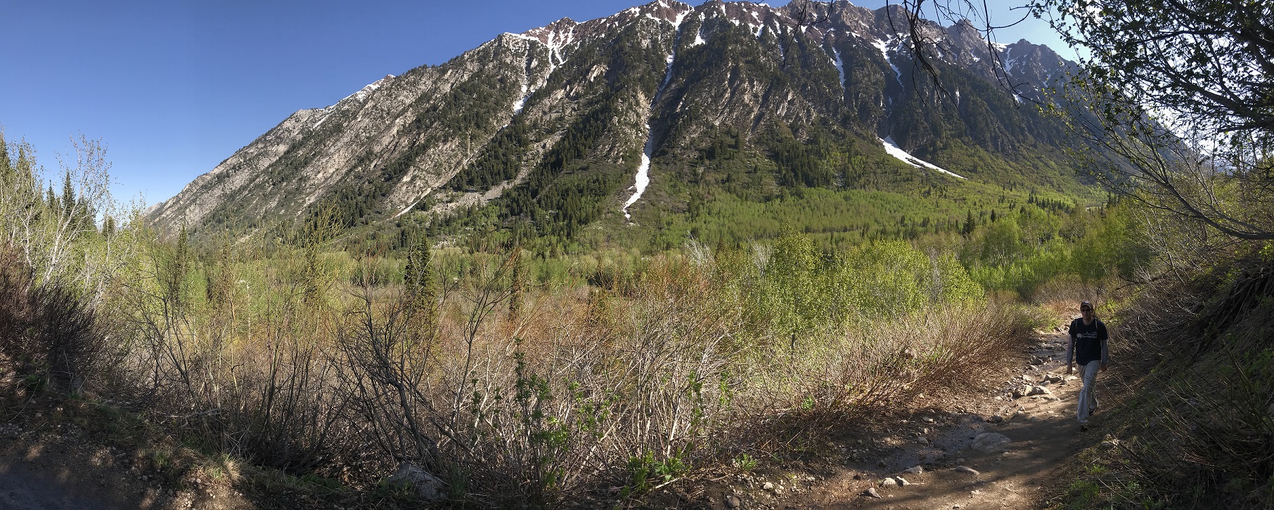
While I had driven through the area a number of times (usually on my way to go rock climbing at Red Rocks National Park near Las Vegas), I had never truly stopped to explore and see what was nearby. The biggest shocker was how close everything was to downtown. In less than an hour you can be from the middle of Salt Lake City, to parked and ready to hike to a mountain lake.
Want to skip to a section? Click on it Below:
Driving to Salt Lake
When choosing somewhere to visit, we like to find a place that at least one of us can drive to in a relatively short amount of time. It makes transporting gear a lot easier when you don’t have to worry about checking a bag.

Fortunately Denver and SLC aren’t too far from Billings. 8-9 hours of driving, or enough to listen to a good audio book, is a relatively short drive to get to a new location with plenty of adventures to behold. Getting into the area I went straight downtown to pick Justin up.
Downtown SLC and Apollo Burger
Justin arrived a few hours before I did. As a city planner for the City of El Paso he is interested in other major cities around the country. He likes to explore and check out how they are laid out, why they’re designed the way that they are, and get ideas that he can take back to his department. So it wasn’t a big deal to wander all by his lonesome for a while.
We had agreed beforehand to check out Apollo Burgers for dinner. It was recommended by more than one friend, so we gave it a shot. They have a simple menu, only a few items on it. I decided to get the Apollo Burger, a traditional cheeseburger topped with pastrami. It was quite amazing; almost worth a trip back to SLC just for another one.

After dinner we headed north to Bountiful, Utah to stay with Lance, friend of mine from high school, and his family. We spent the evening catching up and preparing for the next day.
Drive to Little Cottonwood Canyon
Along the eastern side of Salt Lake City are the Wasatch Mountains. Cutting into the mountains are a variety of canyons; Big Cottonwood Canyon and Little Cottonwood Canyon being two of the more popular. Up these canyons, which are watersheds that provide the majority of the drinking water for the Salt Lake Valley, are ski resorts, biking trails, hiking trails, and a variety of campgrounds. Amazingly, everything is in close proximity to the greater Salt Lake area. From downtown to the trailhead for White Pines Lake was a mere 45 minutes (that would be less if my car had the power to actually go 45mph up the hill). You gain quite a bit of elevation from Salt Lake (around 4,200 feet) to the White Pines Trailhead (around 7,600 feet).
Hike to White Pines
Before leaving the city we stopped to get fishing licenses. I love to fish, and being in Montana I have access to some amazing streams, rivers, and lakes. Being in El Paso, Justin has access to some amazing deserts, arroyos, and cactuses. Even though he fishes just once a year with me, we still find it enjoyable, and occasionally we catch ourselves some dinner. That said, this trip our fishing licenses were a bit of a waste of money.

The hike started off easy enough. We crossed a bridge following the well-maintained trail that cut its way into the forest. As we progressed uphill we quickly came into some snow. We expected a bit of snow, it was only June 2nd after all, and the area had just received a storm a week or so earlier that dumped 24 inches of powder.
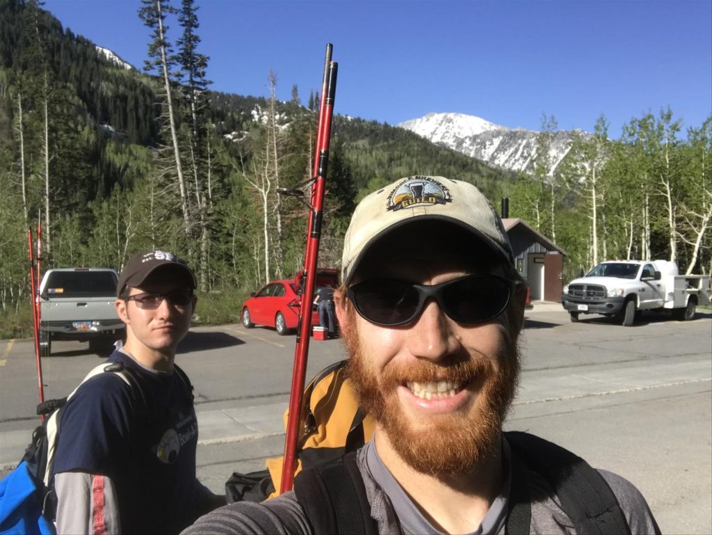
The hike is listed as a “hard” 10 mile round trip hike. If there hadn’t been snow, I would rate it as moderate, and even with the snow it wasn’t that hard. It was just a little more difficult than on dry ground.

Just a mile into the hike we hit quite a bit of snow that was covering the majority of the trail. By 2.5 miles in, halfway to our destination of White Pines Lake, the trail was covered in snow with just a few muddy bare spots. The further up we went toward our destination, the deeper the snow got. The last mile or mile and a half was walking on nothing but snow (maybe the occasional rock to jump on) topping out at what I estimate around 6 feet deep. Fortunately it was compacted due to the late season temperatures and easy to walk on without sinking in more than a couple of inches.

We trekked across snowfields that stretched for what seemed to be miles (in reality they weren’t that big, but without trees and other rocks to reference they appear much larger). The weather was warm, I wore just shorts and a t-shirt, and we were hot when we went over the final rise and saw the blue-green glacial lake below us.
Well, it should have been a lake. Or it would have been had the temperatures been a little warmer. Despite being into the 90’s down in the valley, the mountain had retained its cold temperatures and the lake was almost entirely iced over.

We stopped on a bare rocky part of the shore and had some lunch. A small opening in the ice looked inviting and perhaps I could bring a fish out of the icy depths, but it proved futile. There simply wasn’t enough open water.

After lunch we made our way back down the mountain. In the steeper snow covered areas we sat down and simply slid down the hill, and I wished that we had a sled or skis in order to cut a good hour off the hike out. While leaving we saw quite a few people who were just making their way up the mountain for the day.
A quick search found a brewery on the way to our next destination.
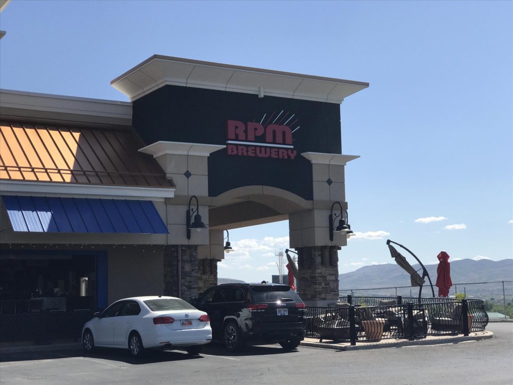
Dinner at Garage Grill/RPM Brewery
The Salt Lake City area has quite a few breweries. Many of them are attached to restaurants that serve up some really good food. But we quickly learned that the state has an interesting law: beer that is served on tap must be less than 4% alcohol. It seems that the stories of Mormon beer are true.
But what gets even weirder is that right next to the draft beers are bottles and cans. These can be full strength, and often will be the same beer that is served on tap (and cost about the same too). So if you’re after a good buzz, just get it in a bottle or can.
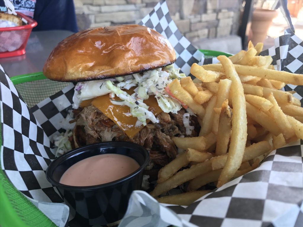
Back to the Garage Grill and RPM Brewery. The food was awesome. I had the pulled pork and cole slaw sammich. I would have ordered the BLT with a fried egg on top, but Justin ordered first and that’s what he got. I can’t order the same thing that’s just weird. I paired my meal with a Hop Rising Double IPA from Squatters brewing; a clean 9% ABV and a hop crispiness made it the perfect end to a day of hiking.

After our meal we were off to find our next campground.
Diamond Fork Campground
We drove south of Provo, and turned off the interstate at Spanish Fork on what seemed like it should have been a little used highway. But it was pretty heavily trafficked. A few miles into the mountains and we turned off that onto Diamond Fork Road; a little used mountain road.
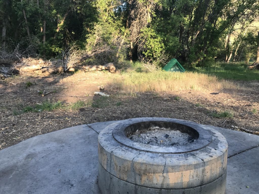
A few miles down we found the Diamond Fork Campground. It was a developed campground, and despite there being quite a few people nearby it wasn’t crowded or overly noisy. We just needed a place to crash before heading to the hot springs the next day. Before the sun got too low in the sky we drove up the canyon to check out the trailhead and determine where exactly we were going.

Back at camp we enjoyed brews, sat by the concrete fire pit, and made farting noises.
Fifth Water Hot Springs
Fifth Water Hot Springs was one of our primary destinations. From the time we decided that the Salt Lake area was where we should go, it was on the list of places to visit. The pictures online showed some really cool areas of the river, neat mountains nearby, fun vegetation, and of course hot springs.

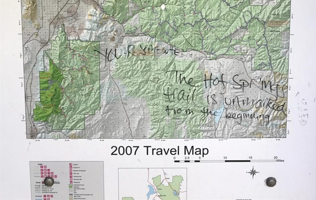
We arrived relatively early, and started hiking just after 9am. Despite being early, the parking area was already packed. It was a Saturday after-all, and the trailhead spawned multiple trails; so the hot springs aren’t the only destination in the area. But they seem to be the most popular, despite not being on the map. When you start on out your hike, the map won’t show the hot springs. Don’t be dismayed, someone scribbled in sharpie to head straight. You hike alongside the creek instead of crossing the little bridge over the creek.
The hike is roughly 3 miles, but you get to see some amazing views. The creek is running right next to you the majority of the way, and there are tiny waterfalls and all the other wonders that creeks bestow. The vegetation is awesome too. The previous day we were in high alpine with pine trees and the typical plants we see often in Montana. Today we were down lower in the desert with desert oak trees, junipers, and some scrubby bushes that I have no idea what they were. Plus, we found cicadas; check out the claws on this guy!
Less than an hour and we had arrived at the lower edge of the hot springs. Here there are some pools that have been built out of stone, a 12 foot waterfall, and plenty of areas to sit. The only problem was that we didn’t want to be around so many people. It was 10:15 in the morning and there were a dozen or so bathers nearby. We decided to hike above the waterfall just to see what we could see.

That decision turned out to be a good one. There were two ladies walking down, and they said there were some pools 100 feet up and nobody else around. We kept going and found the best bathing spot at the hot springs. Two pools, the gurgling river right there, and nobody there… yet. Eventually they would come.
For a while Justin and I had the place to ourselves. The upper pool had a small hole in the rocks where the cold water from the river would pour in. But best part was the floor of the pool. It was covered in tiny pebbles, and the hot water would come from beneath. In fact, the floor was so hot I couldn’t even put my feet on it. These pools were like hot tubs, they had little rock benches to sit on, a little platform behind us to rest our drinks, and best of all the upper pools are in the shade. I had lathered up with sunscreen before leaving the car, but forgot to stuff it in my pack; so the scrubby oak tree was a blessing that kept us from frying.
We lounged for about 2.5 hours, and then decided we were wrinkled enough. A 3 minute hike further up the trail and we were able to get some pictures of the waterfall. Then it was back down. The lower area, near the waterfall, was even busier now. And there was no shade to be found. So despite our desire to check out the other pools, neither of us wanted to sit around in the sun and turn into tomatoes. We hoofed it back to the car passing roughly 3,754 people on the way out.
Red Ledges Picnic Area
Along the road we noticed there was a little picnic area. The area was a bit different than the rest of the mountains, and seemed to be comprised of red sandstone. We determined that on our way back from the hot springs we would stop and have a snack and hike around a little bit.
It’s a cool area, the rock formations are awesome. If you’re a rock climber there are some routes that are bolted, and the approach is about as short as you could ever hope for. It’s a fun little area that’s worth a stop if you’re driving by, but wouldn’t be worth the trip just to visit Red Ledges.
Bohemian Brewery
No trip is complete without checking out some local breweries. As we headed back into the Salt Lake area we passed through Midvale, Utah (just south of Salt Lake City), on our way to Little Cottonwood Canyon. Our plan was to camp for the night, so we figured we would grab a tasty beverage before heading back into the mountains.
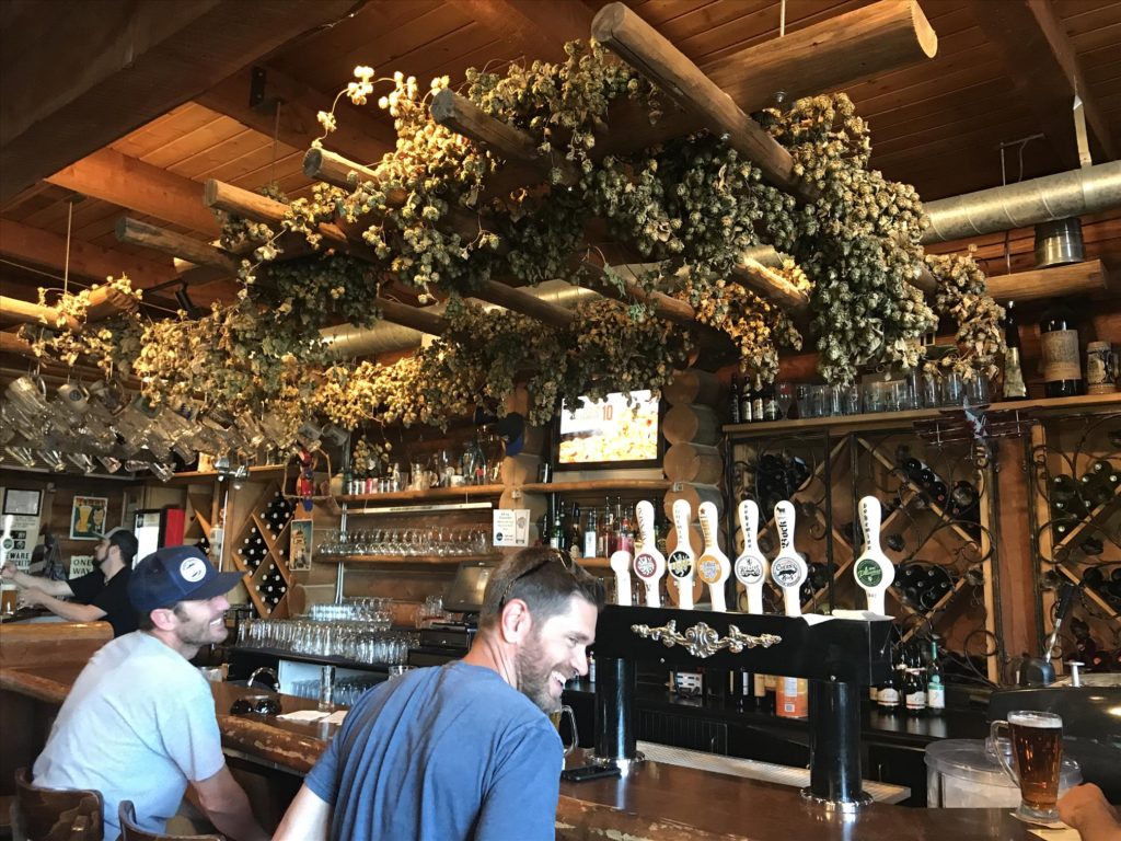
We ended up at Bohemian Brewery, a lager house modeled after brewing in Bohemia (an area in what is now Eastern Germany and the Czech Republic). The goal of the brewery was to re-create the beers that would have been popular throughout the middle ages. But not just the beer, the entire feel of the lager house. They had a great variety, some delicious food, and a really cool experience.

Justin tried to order an IPA. The waiter gave him a look and said, “Well… we’re a lager house, so we don’t have ales.” I gave Justin a squinty eye look and told him to expand his tastes.

After finishing our beers we made our way up Little Cottonwood Canyon toward Snowbird.
Camping at Tanners Flat Campground
Our research found us a campground near the trailhead to White Pines. What our research didn’t show was that weekends near SLC cause the mountains to be packed with people. The campground was likely booked many weeks ago, and a sign placed at the entrance that said they were full. We pulled in and got on our phones looking for somewhere else to stay; we even kicked around the idea of just sleeping on a park bench. While the canyon is public land, the cliffs are steep and there aren’t too many places where you could find to just throw down a tent. We had to find something that was designated camping.
We were parked for at least half an hour when the campground host came by. She asked what we were doing and when we explained it to her, she said, “oh we have overflow camping if all you need is a tent spot!” We gave her squinty eyed looks and then realized we didn’t have cash or checks with us. We had to drive down to the valley, hit up Wells Fargo, then back up to camp. Fortunately it wasn’t far from the city.
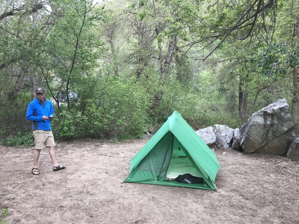
The campground was interesting. It had a large common area with half a dozen picnic tables and a community fire pit. Off to the side were some grills where we set up our stove and cooked dinner. The canyon is a watershed for the Salt Lake valley, which means they get their drinking water from the run off. It also means that if you have a dog, don’t bring him because they’re not allowed, and it means you have to take great care with your water disposal. We were instructed to wash our dishes in the bathroom (which had running water, electricity, and all sorts of fancy amenities like that).

We hung out with our neighbors around the fire pit, we were startled when two moose walked along the creek 10 yards away, and eventually found our way into the tent so we could rise early and get a halfway decent parking spot at our next adventure.
Keep this in mind, if you’re just looking for a place to put a tent, Tanner’s Flat Campground has overflow spaces; just find the camp host.
Hike to Bell Canyon Reservoir
On our list was Bell Canyon Reservoir. The biggest reason was because we could get a good view of the valley as we hiked up. It was on the very outer edge of the mountains, and the parking lot was literally right across the street from an upscale subdivision. Our goal to get started early paid off, the parking lot was already crowded even though we arrived at 8am.
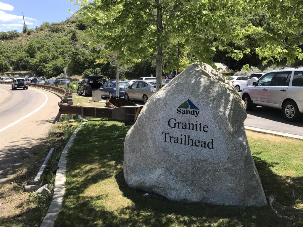
The reservoir is an easy hike, and just a mile or so. There were plenty of people up there jogging or doing a little day hike. Being right on the edge of the valley it was hot, and we were thankful for sunscreen and hats. Our goal was to fish the canyon for a little while, and then venture up to the waterfall.

When we arrived at the reservoir we discovered you weren’t able to use live bait (that whole watershed thing), and it was catch and release only. We weren’t too worried, catching a fish or two is still fun and we passed fishermen on the way up that had said they were biting. We found a spot and fished with no luck. We tried all sorts of lures, jigs, and spinners, and nothing was grabbing on.
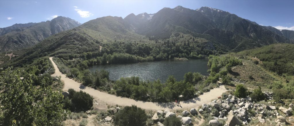
After a while we got tired of not catching fish, so we tried to walk around the lake. Unfortunately the outlet of the reservoir was too full and with no bridge we couldn’t get around. We climbed up on a little knoll to get a great view of the reservoir, and then decided it was time to hike to the waterfall (before it got too hot).
We hoofed it back to the “back” of the reservoir, the area closest to the mountain, and took the distinctly marked trail that was going to take us up.
Hike to the Waterfall
Online the hike was described as hard. The comments said something along the lines of, “it’s a lot more strenuous than the description makes it out to be.” Of course this threw Justin into a panic and before the trip I had a flurry of text messages talking about how we should have a backup plan in case it was too hard. Naturally I mocked his fear because that’s how I roll.

The sign said the waterfall was a mere 1.2 miles away. That doesn’t seem so bad, and the first part of the trail is easy. It starts to go uphill a little bit, and eventually you cross the creek on a wooden bridge. After that you hit the Lone Peak Wilderness in the Wasatch National Forest. From there it’s .7 miles to the waterfall, and the hike does get strenuous.

Strenuous, however, doesn’t mean dangerous. In fact, there were so many people up there the most dangerous part would be bumping into someone else. For over half a mile you essentially climb stairs. It’s that steep. But the path is through the trees, there are no loose rocks, and all those people around meant that if something bad did happen, there was bound to be at least a few people to help.

As you get to the waterfall the roar gets louder and louder. Suddenly the trail almost just stops because everyone diverges to the left and finds a place to sit and have a snack and watch the rushing water. Early in the year, like when we were there, the creek is swollen with snow melt, and the waterfall is huge. In fact, the most dangerous part of the hike would be slipping and falling into the creek.
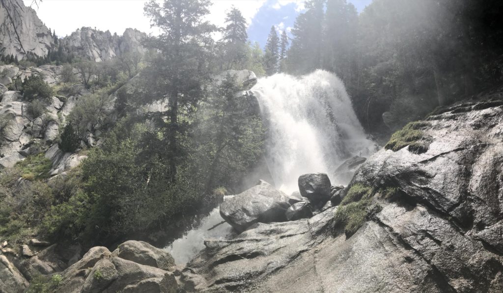
Down the valley we had a great view back into civilization. Behind us the water roared, and the cool mist helped alleviate the pain of hiking in the hot temperatures. We ate our lunch, took a boatload of pictures, and decided that although hiking another 2 or 3 miles to Upper Bell Canyon would be awesome, it was going to be even steeper and more strenuous. By this point we were tired, we had seen some awesome sites, and we were mostly interested in having beer.
So that’s what we did. We went on a mini beer tour of the Salt Lake City area.
Shades of Pale, Fisher Brewing, Squatters Pub
First stop on the way back toward downtown Salt Lake City was Shades of Pale. GPS took us right to the building which was conveniently located in an area where you wouldn’t want to be after dark. Of course you can’t access the brewery through the front of the building, and there’s a little sign directing you down the alley. A walk down the alley led to a loading dock with a miniscule sign over the service entrance.

Once inside you walk through a long hallway back toward the front of the building. When you reach the tasting room there’s a chalkboard sign that says something along the lines of “Wait here to have your ID checked.” But there was nobody around (save a couple of gentlemen at a table enjoying their pints). I had to pee really bad, so I poked around for a bathroom when an employee came from a back room and stated, “Having trouble reading the sign that says wait here?” I explained I was looking for the bathroom, but he didn’t seem very happy with that response.
Our pints were marginal, the atmosphere was bad, and so we headed to the next place quickly.
The next stop on the list was A. Fisher Brewing Co. The area was nicer, there was a large sign across the front that made sure you couldn’t miss it, and going inside we could see that we would have more fun here; it wasn’t packed but there were a lot of people inside.

We talked with the staff a bit, tried some beers, and actually enjoyed the tasting at Fisher. If you’re in the area, I recommend visiting this brewery.
After getting back to downtown Salt Lake City we looked for Salt Lake Brewing Co. Justin had mentioned that he stopped there while waiting for me to get into town. Despite our efforts, however, we couldn’t find it online or on Apple Maps. Until we realized that the name of the pub isn’t Salt Lake Brewing, but rather Squatters Pub Brewery (in the old SLC Brewing building perhaps).
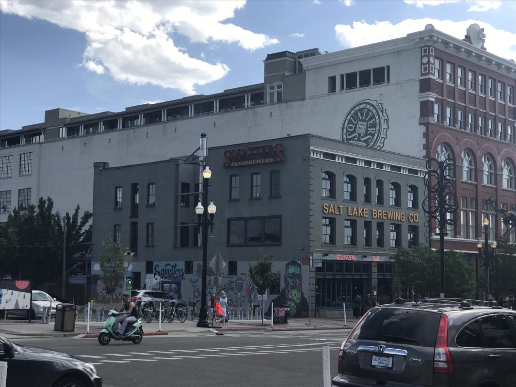
This place was packed. On that day there was a rainbow parade in Salt Lake, and all the downtown businesses were bustling with people that were either in the parade or had gone as spectators. We also happened in there shortly before the dinner hour, so people were getting an early meal. We tried a couple of pints and decided to head a couple blocks over to tour the LDS main campus.
Touring the LDS Campus
The campus, which is technically called Temple Square, takes up a significant portion of downtown Salt Lake. With 10 acres of prime real estate in SLC, it’s an interesting place to visit.
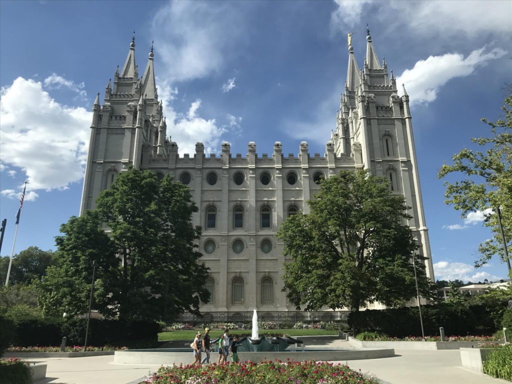
The campus, and the buildings, are kept incredible clean. There are missionaries who give tours and answer your questions. You can tour the small museum that talks about how the original temple was made with hand tools and crafted over 100 years ago. While you can’t go inside the temple, the museum does have a cutaway model that shows each of the rooms and how it’s all organized.
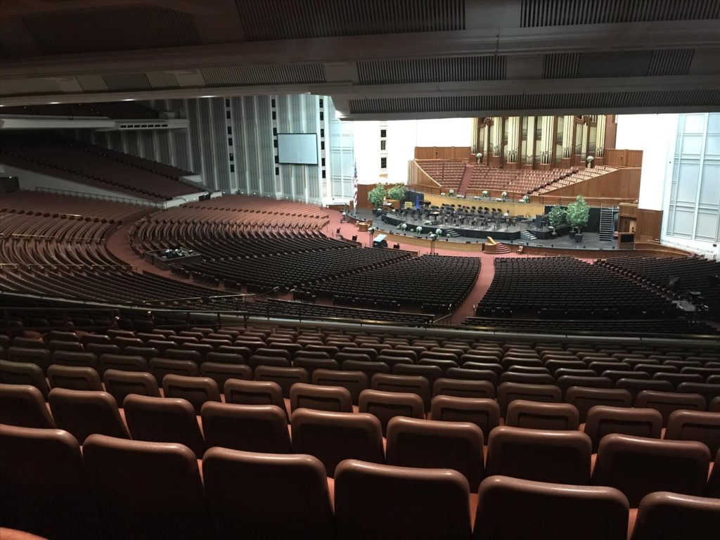
Since it was a Sunday when we visited, we weren’t able to go inside some of the buildings. We took a peek around the tabernacle and the conference center that seats roughly 18 million people. It’s some impressive architecture.
Side By Side Ride to Bountiful Peak
That evening we stayed with Lance again. He lives right up near the mountains in Bountiful, and has access to some really cool mountain roads. After dinner we loaded into the side by side and we drove up the mountain to get a sweet view of the valley.
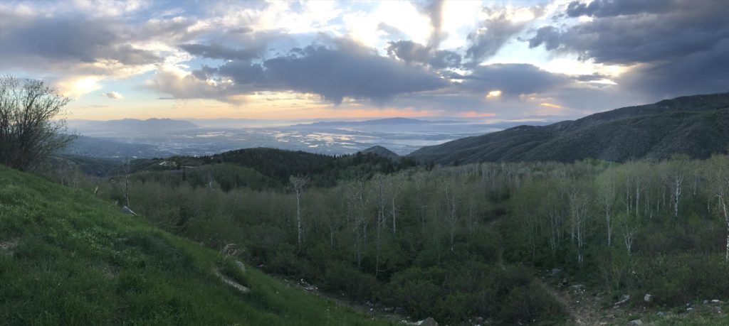
Since it was still pretty early in the summer we weren’t able to get all the way to the top due to the road being closed. But even from most of the way up Bountiful Peak we had great views of the sunset.
City Creek Mall and a Parking Ticket
The next day Justin and I had a bit of time before I had to get on the road. We went back to downtown where he could easily catch a bus or train to the airport and decided to explore the City Creek Mall.
The mall is an open air mall with a closable roof. It can be an outdoor mall in the summer, and indoor in the winter. A natural creek flows through the middle of the mall creating a great water feature that meanders all around the mall. The best part of the trip to the mall, however, was getting a parking ticket for parking legally.

Pulling up to the mall there are kiosks to pay for the spot. I walked down and noticed it was $2 for 1 hour. I read too quickly and thought it was $1 for 2 hours. I purchased the hour and noticed the expiration was sooner than expected. Fortunately, you can simply swipe you card again and pay another hour, the second ticket showed the anticipated length of time.
After walking around the mall and exploring for less than 2 hours, we went back to the vehicle. Justin would get his stuff and I would start the drive home. There was a parking ticket on my windshield. The ticket indicated it was for taking up two parking spaces, but that was scratched out, and something illegible was handwritten in its place. Fortunately the appeals process was only a couple of emails and it was thrown out.

Justin and I had a teary eyed goodbye and vowed that next year we would take another trip, and I could take another 6 months to finish writing about it.


