Fighting Skeeters on the Way to Kersey Lake
Have you ever zipped up the tent only to find a mosquito stuck inside?
EEEEEEEEEEEEEEEEEEEEEEEEEEEEEEEEEEEEEEEEEEEEEEEEEEEEEEEEEEEEEEEEEEEEEEEE!!
Despite that fact that you’re about 15,000 times bigger, this miniscule insect can drive you bonkers. It’s a single insect, but it has the power to irritate and exacerbate. Now imagine hiking along the Clarks Fork Trail on your way to Kersey Lake, surrounded by hundreds, nay, thousands of these irritating bugs.
If the mountains are calling, and you choose to go to Kersey Lake, make sure you bring bug spray so that you’re not eaten alive. Then you can enjoy the easy 2ish mile trek to a deep lake that is teeming with brook trout in the heart of the Custer Gallatin National Forest.
Over the Top on the Most Beautiful Drive in America
CBS correspondent Charles Kurult described the Beartooth Highway as “the most beautiful drive in America.” This 64 mile stretch of Highway 212 starts after you pass through Red Lodge, takes you up and over the top of the mountains while dipping down into Wyoming before venturing back into Montana just before Cooke City and the Silver Gate entrance to Yellowstone National Park.
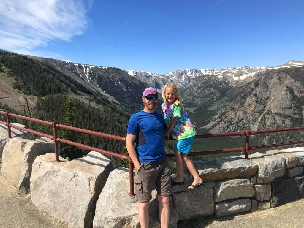
As you ascend the highway, the views open up. You can gaze deep into the canyons lined with jagged cliffs. Roll down the window and feel as the air temperature steadily drops as you take each of the hairpin turns switchbacking your way higher into the atmosphere.
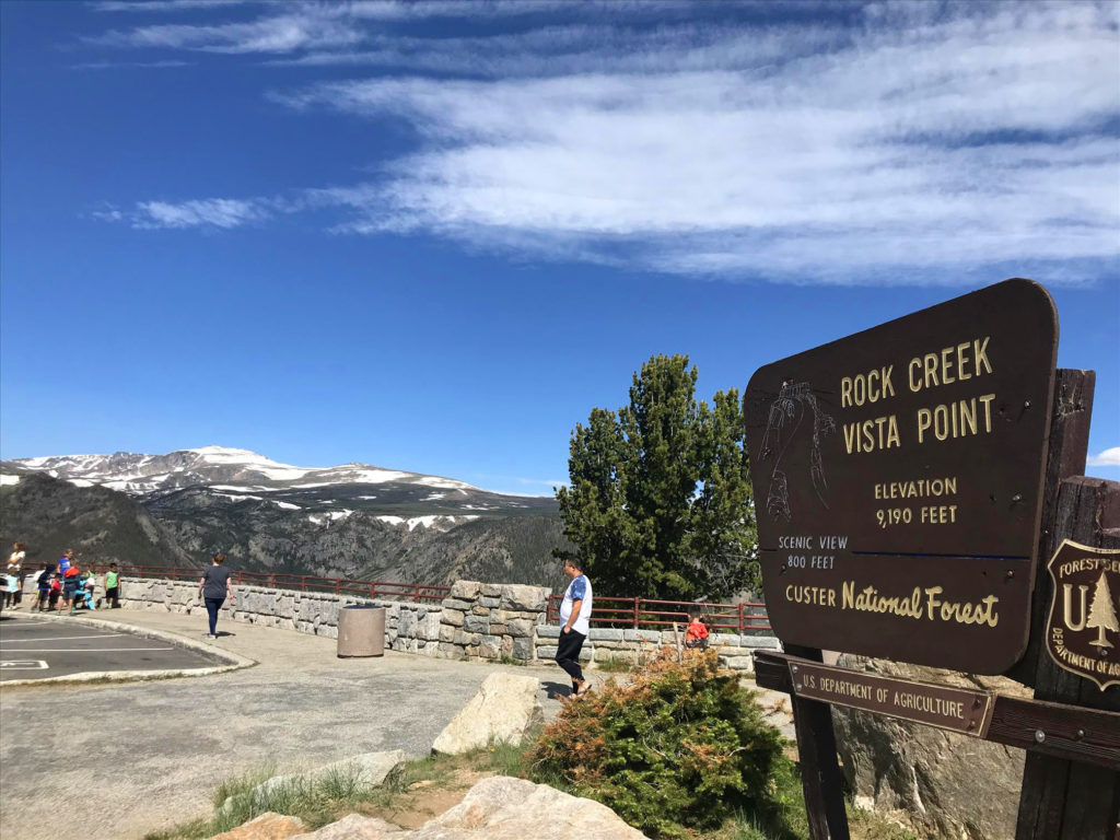
No matter how many times you cruise up the highway, it’s almost an obligation to stop at the Rock Creek Vista Point. Here, you can peer into the canyons below, have a quick bathroom break, and watch tourists feed nuts to the chipmunks and ground squirrels as they fatten up all summer long. It is here, slightly over 9,100 feet of elevation, that you start to notice the trees getting smaller.
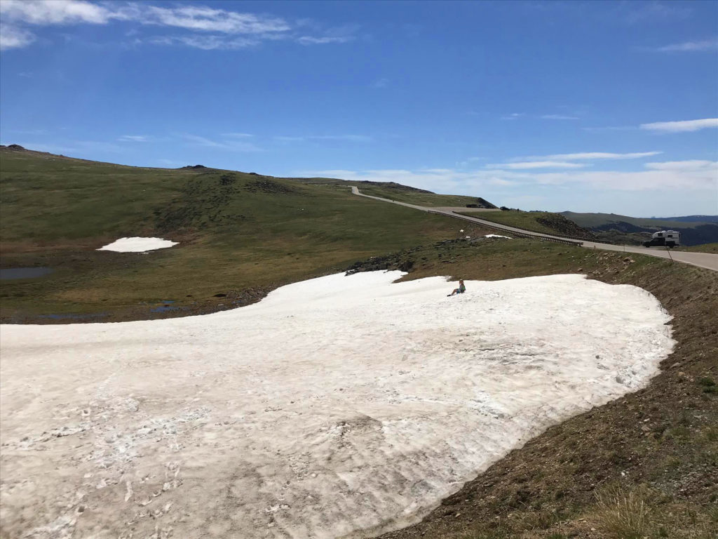
Around 10,000 feet you hit the tree line. The diminutive shrubs give way to tundra-like landscape. Snow lasts well into the summer and the sides of the highway are lined with those recreating by skiing, snowboarding, or simply getting out and throwing snowballs at each other when the thermometers are tipping 90 degrees in the valley below.
If you keep an eye open, the vast fields of greenery may be dotted with mountain goats grazing amongst the wildflowers.

It’s easy to spend hours upon hours playing in the snow, carefully looking down the sharp cliffs, carving your name into a 10 foot deep snow bank, or even checking out the high mountain lakes that are frozen a significant portion of the year. But if you want to beat the afternoon thunderstorms, you have to press onward to the destination.
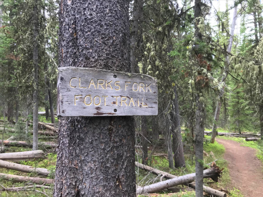
Clarks Fork Trail – The Start of the Beaten Path
Barely a mile after you return to Montana, having dropped significantly in elevation from the upper reaches of the highway, as you approach Cooke City, there’s a small parking area for the Clarks Fork Trailhead.
In the mountains to the north, near Granite Peak, Montana’s high point, the snow melt fills lakes and streams. These combine and widen as they head south, turning abruptly to the east at the trailhead. These waters will eventually tumble down through the mountains, pouring out of the mountains and progressing through the plains below. Soon their meanderings will take them past Laurel and dump into the Yellowstone River.
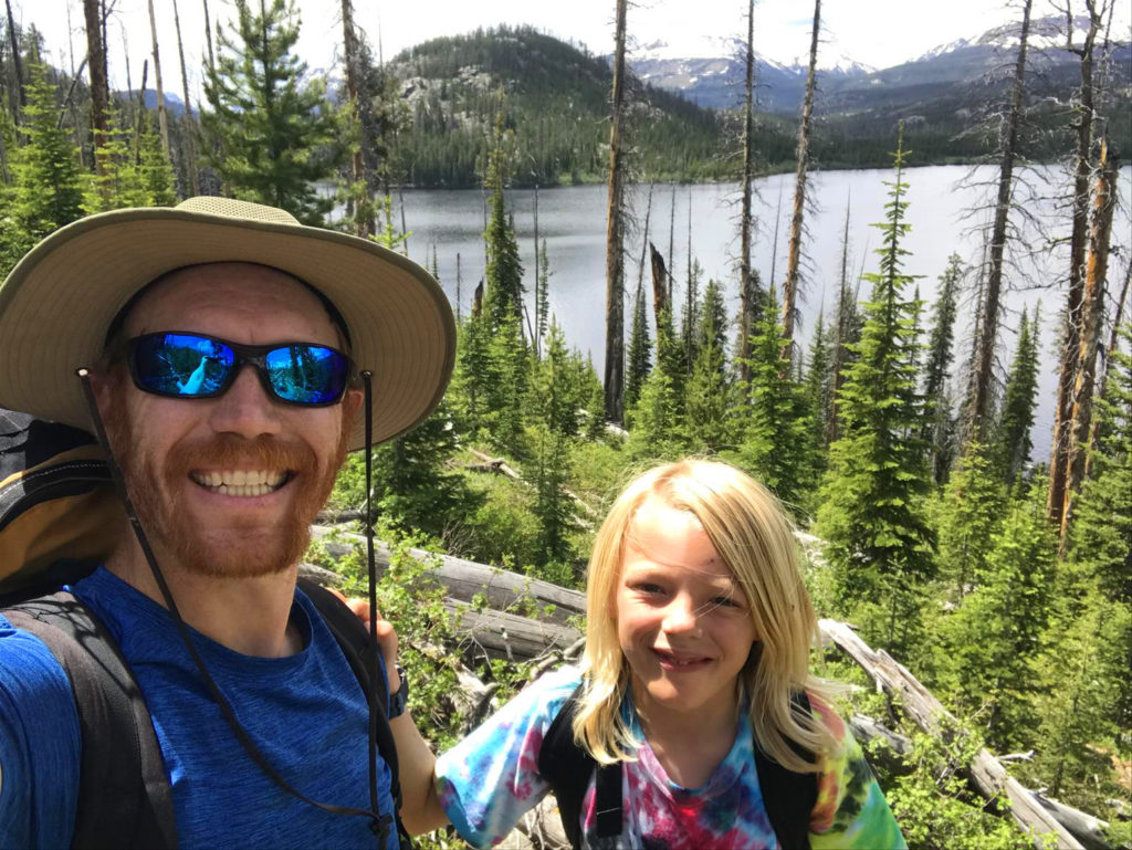
But here, high in the mountains, is the start of many beautiful hikes. Some are short and easy, others, like the Beaten Path will wind you up and over and down to the East Rosebud Valley carrying you along for over 26 miles. It is this very trailhead where my passion for the outdoors began.
Sometime around the age of 10 my dad took my brothers and me to Rock Island Lake. A 3ish mile hike without a ton of elevation gain. It became an annual tradition, which grew into exploring many more areas of the Beartooth Mountains.
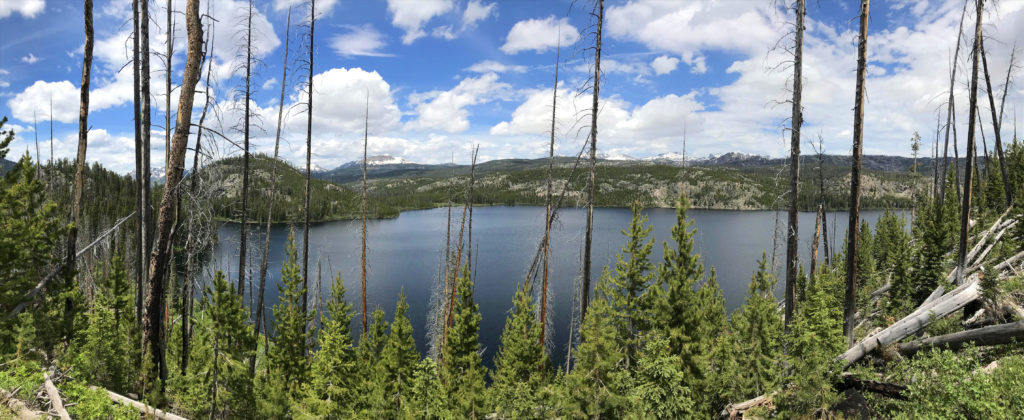
But today, we wouldn’t go that far. Today, our goal was to get to the far end of Kersey Lake.
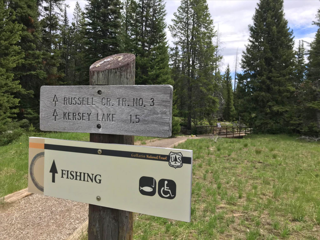
Three Routes to Kersey Lake
When you get to the trailhead, you are poised for one of two routes to the lake. The third is a couple hundred yards down the highway, and if you have a good four-wheel drive vehicle, you can actually drive right up to the west shore of the lake. Bring a canoe or kayak and you can troll through the depths pulling out one of the rare lake trout that lurk in there.
The problem, however, is that the waters are shallower on that end. Fishing from shore isn’t as effective.
Progressing along the trailhead, the path essentially starts as you cross the Clarks Fork River on a wooden bridge. Below, the water rages through the canyon cascading over waterfalls. The waters once provided hydroelectric power, but now are allowed to flow freely.

Crossing the bridge, you expect that the mosquitoes will dissipate. They unfortunately do not. Instead, you walk through the low wet areas, and they become much worse. As your heart rate picks up, and you breathe more heavily, they come in swarms. Stopping means you get eaten alive. Of course it’s all avoidable with some good bug spray from the start.

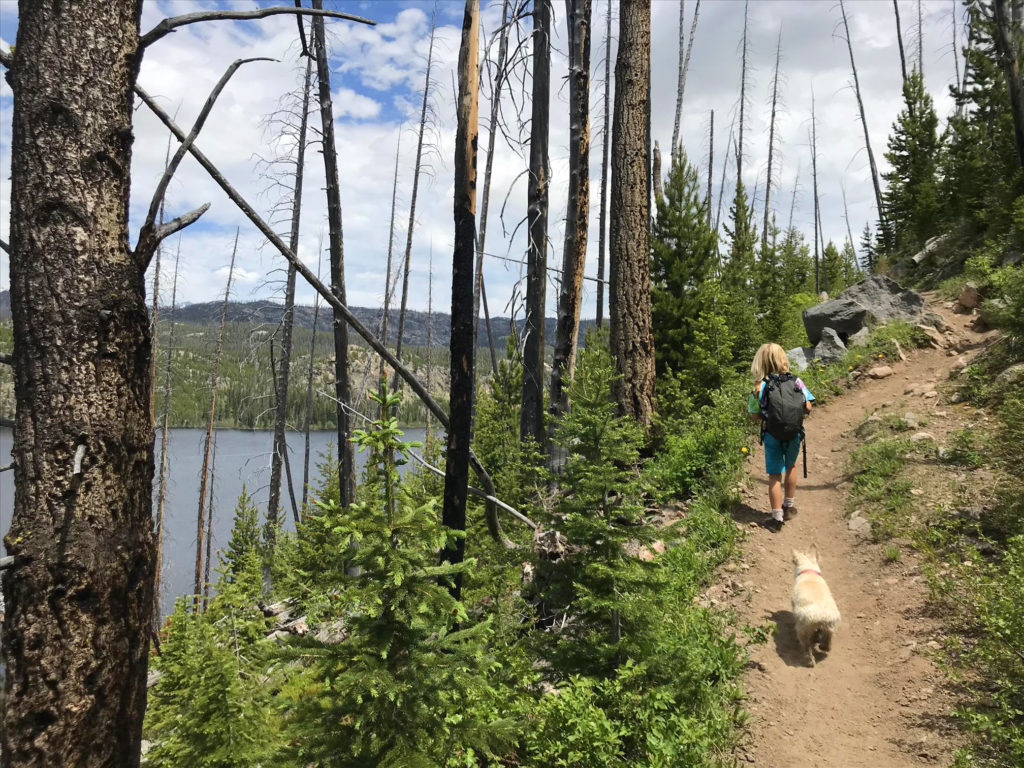
Soon the trail splits. You can head to the left and quickly meet up with the southwest corner of the lake. Or continue uphill traversing the side of the mountain with the lake glistening below. As you approach the eastern edge of the lake, the trail drops down in elevation again. Here, to access the lake, you must bushwhack through the fallen timber until you reach the rocky shore.
Here Fishy Fishy Fishy
Lakeside there’s a respite from the mosquitoes. Just enough breeze comes across the water to overpower the tiny creatures. During the lulls, they come back, but they’re quickly blown away again causing less agony than on the hike.
The water drops off quickly off the rocky shore. Standing on the boulders we tossed out worms on hooks and a variety of spinning lures. The hungry fish took a liking to the worms, but they were small and not quite large enough to bring home for dinner. If more time was available to test different strategies, we could have played with the depth to see if deeper meant bigger fish.
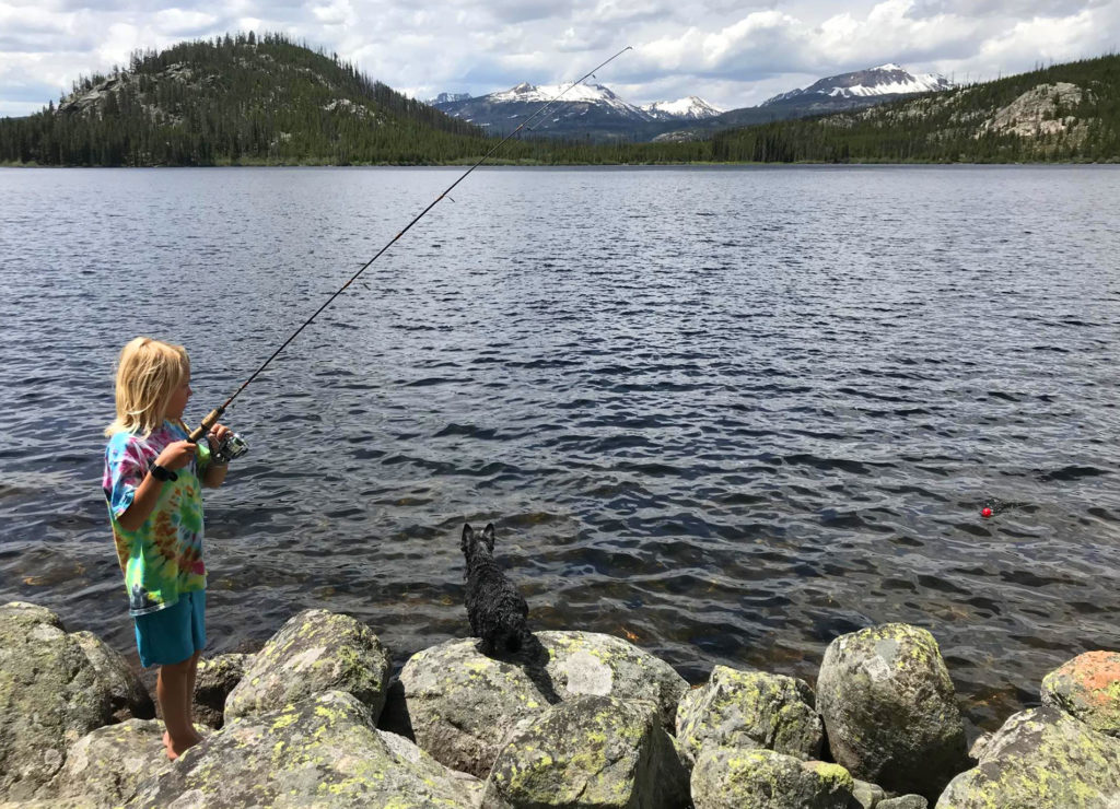
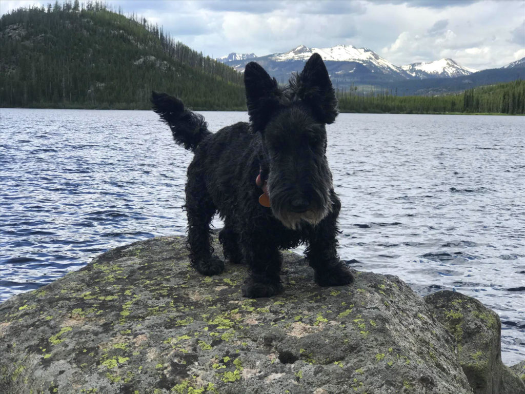
Lunches were had, fish were caught and released, dogs fell in the water chasing the escaping fish. The decision was made after a couple of hours that we should head back. Clouds were moving in and our goal was to get back to Red Lodge and order a pizza from Red Lodge Pizza Co.
The entire hike, around 2.5 miles took hardly over an hour. Not two minutes after arriving back at the vehicle, thunder clapped nearby proving that our decision to head back was timed just right.
When the mountains are calling, go.